
Our modern lives are ruled by the geography of our area. Rivers, mountains, lakes, and ponds impede travel, forcing a road to go around them.
 Unfortunately, maps have fallen out of favor thanks to satellite technology and the GPS in our cell phones. Many people don’t know how to read a map.
Authors might want to develop this skill because maps (and the ability to understand them) are a useful tool for authors of any fiction set in any place and time.
Take a look at the geography of your home area. As I mentioned last week, where I live, the shoreline of Puget Sound and the foothills of the mighty Cascade Mountains determine the interstate highway’s path and the locations of cities and towns. Those detours add to the distance we must travel and increase the time it takes to go from one place to another.
My best tool is my storyboard. It is an Excel workbook that is one of the most valuable tools I have to aid me in worldbuilding. This workbook is a warehouse of information about my work-in-progress.
I have talked a lot about storyboards, so for more on how to create one that works for you, go to Worldbuilding – the stylesheet/storyboard.
If you are writing a contemporary novel or historical work set in our real world, this is where you might want to go to Google Earth and find real-world maps that will help your characters navigate their city or countryside.
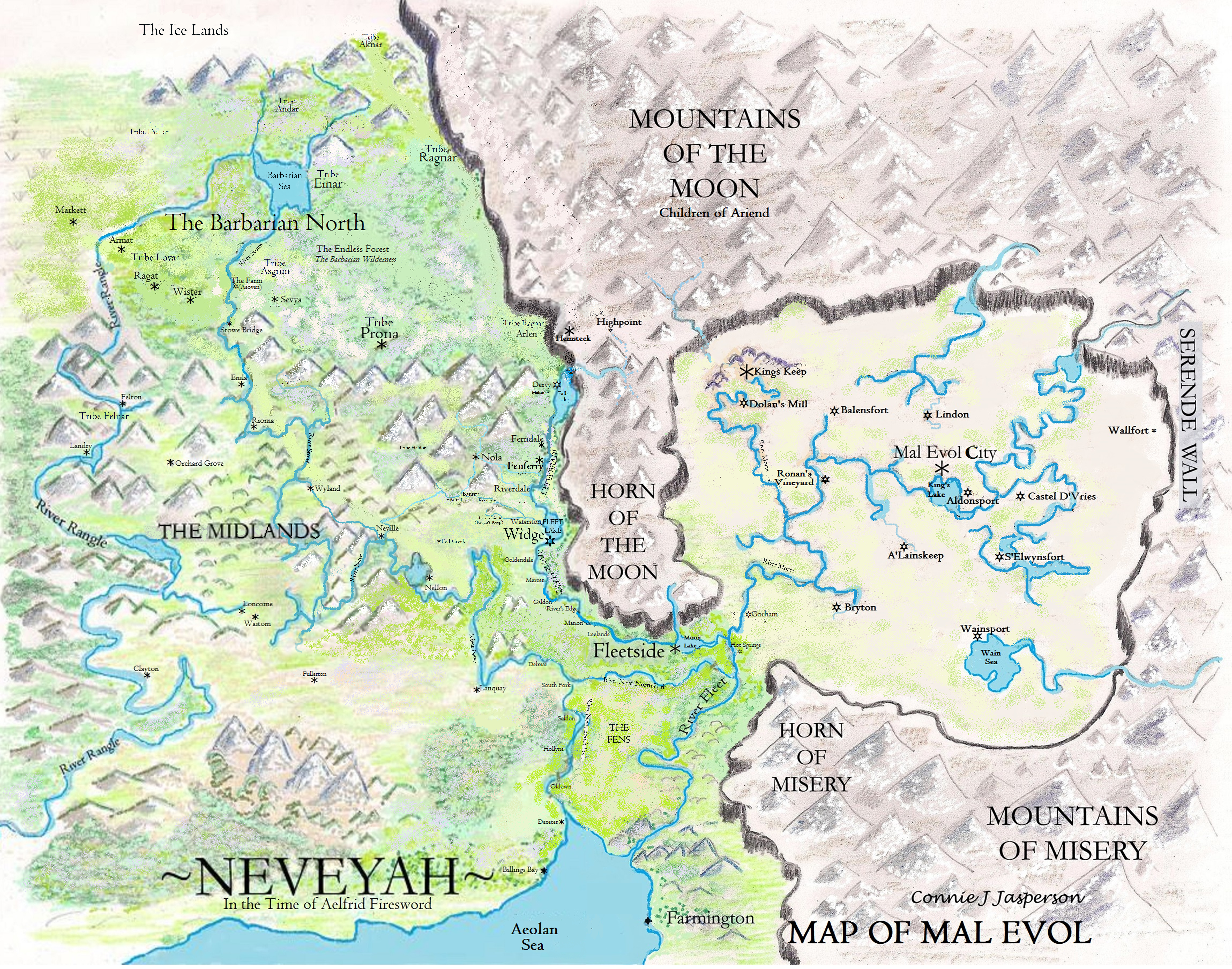
But maybe you are designing a fantasy world. In that case, you only need a pencil-drawn map such as this one:
But maybe you want to go a little deeper into visualizing the world your characters inhabit. When I am stuck, working on my map helps me visualize what has to happen next in the story. I love adding texture to it, putting the mountains where they belong, and showing where the grassy plains are. Frankly, I like to make art, so it’s a relaxing way to get through a temporary block.
 Maps can show us far more than where mountains and rivers are located. They can show us political or ideological boundaries. Countries’ borders must be accurately shown and regularly updated on modern maps. Like every other professional, mapmakers are proud of their work and want everyone to be able to use and understand their creations.
People have been making maps since the advent of writing systems. The ancient Egyptians were the first civilization to regularly use the cardinal points (north, south, east, and west) for orientation in mapmaking, and your map should too, or only you will understand it.
- North will be at the top, east to the right, south to the bottom, and west to the left. The points quarter the map at 90-degree intervals in the clockwise direction. This is standard in modern maps.
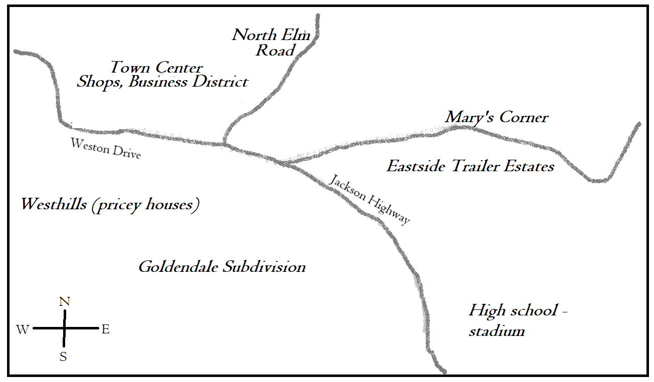
Even if your story is set in a town, you might want to map it out. The lines and scribbles you add to your map are the information you can use to check for consistency in your narrative.
If, in chapter one, Hero leaves home and follows the river north to the Big City of Smallville, he won’t reach home in time to save his mother if he then races east in chapter ten. He must return south, and your notes on your little map will help you remember this.
Or perhaps Hero lives in a city and wants coffee at the shop two blocks north of his apartment. He will have to return past the same shops and buildings he passed on the way. If some of the action occurs in those buildings, you want to have your map out and update it as needed.
Use a pencil, so you can easily note whatever changes occur during revisions. Your map doesn’t have to be fancy. Lay it out like a standard map with north at the top, east on the right, south at the bottom, and west on the left.
In my experience, the first draft of a map is never beautiful. And things will evolve as you make revisions to your manuscript. This is how my maps look after I’m done with the first draft:
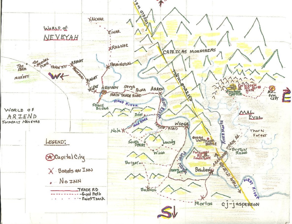
Original Map of Neveyah from 2008 © Connie J. Jasperson
You may need to note where rivers and forests are situated relative to towns, or in the case of towns, what streets and cross streets our Heroes must travel.
Many towns are situated on rivers. Water rarely flows uphill. While it may do so if pushed by the force of wave action or siphoning, water is a slave to gravity and chooses to flow downhill.
A river may emerge from a mountain spring or a glacier, but it will flow downhill to a valley where it will either continue on to the ocean or will pool and form lakes and ponds. Farms are usually situated near water sources. When making your map, locate rivers between mountains and hills.
On your fantasy map, geography makes travel difficult, forcing a road or trail to go around the various obstacles. This creates opportunities for plot points, because the struggle is the story. Those detours add to the distance and increase the time it takes to travel using the common mode of transportation.
In my part of the world, the native forest trees I see in the world around me are mostly Douglas firs, western red cedars, hemlocks, big-leaf maples, alders, cottonwood, and ash. Because I am familiar with them, these are the trees I visualize when I set a story in a forest.
What makes up your written world? How does your environment affect the way your characters live? Remember, the world is shown through the three senses: sight, sound, and smell. What one sees, smells, and hears in the wilderness is very different from what they experience in the city.
Cities have as complex a geography as a wilderness does. It is created by the terrain on which the city was built and its architecture.
The largest city in Washington State is Seattle. It lies between the salty waters of Puget Sound and the fresh waters of Lake Washington, the largest natural lake in western Washington. This geography affects our modern society by limiting where highways can be built and by determining the best places to build tall buildings or create suburban neighborhoods.
Humans have always created communities where resources are plentiful. Villages arise along rivers, forests, and lakes. These geographical places provide resources that allow people to thrive.
Humans prefer valleys for farming and also alter the visible landscape to suit their needs.
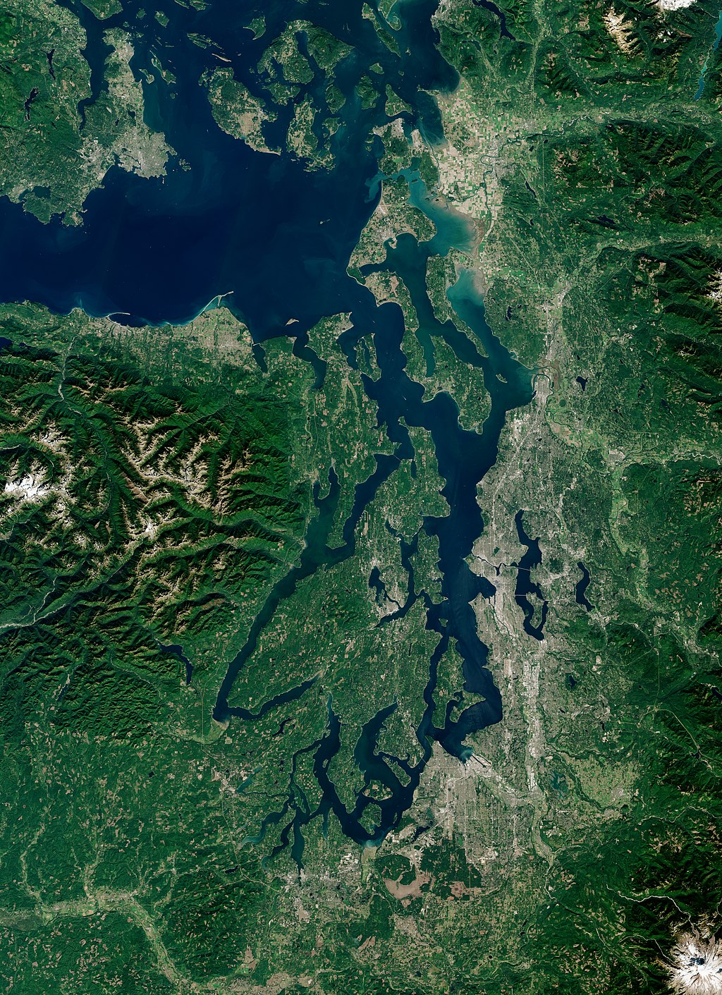
Satellite View of Puget Sound by Sentinel 2
We cut trees from the forests to build homes and create farmlands. We redirect rivers to provide irrigation or (in modern times) power. We build canals for easier travel and to enable faster shipping commerce.
Your narrative will describe the various terrains and obstacles your characters must face. A little map drawn on notepaper will help you keep things on track.
Maybe you aren’t artistic, but you think you will want a nice map later. In that case, a little scribbled map and a few indications of distances and obstacles will enable a map artist to provide you with a beautiful and accurate product. An artist can give you a map containing the information readers need to enjoy your book.
If you choose to include a map in your book, you will make readers (like me) happy.
Credits and Attributions:
IMAGE: Map of Neveyah © Connie J. Jasperson 2026
IMAGE: Original Map of Neveyah from 2008 © Connie J. Jasperson
IMAGE: Satellite View of Puget Sound, Wikimedia Commons contributors, “File:Puget Sound by Sentinel-2, 2018-09-28 (small version).jpg,”Wikimedia Commons,https://commons.wikimedia.org/w/index.php?title=File:Puget_Sound_by_Sentinel-2,_2018-09-28_(small_version).jpg&oldid=1114501049(accessed April 5, 2026).


